NASPMON
Seismic Tomography in Reykjanes Peninsula, SW of IcelandSeismic Tomography in Reykjanes Peninsula, SW of Iceland
Working package WP6 of the NASPMON project
Synopsis
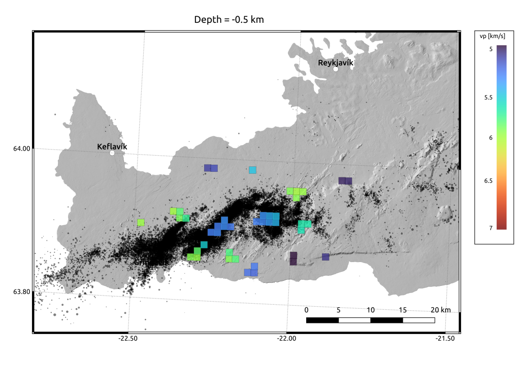
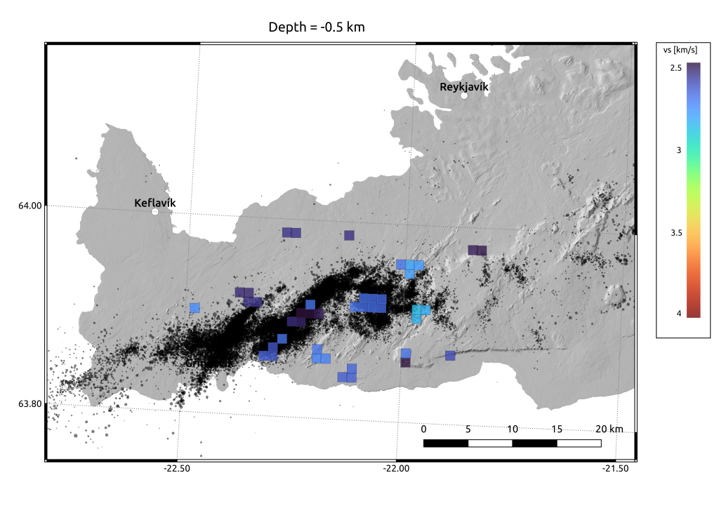
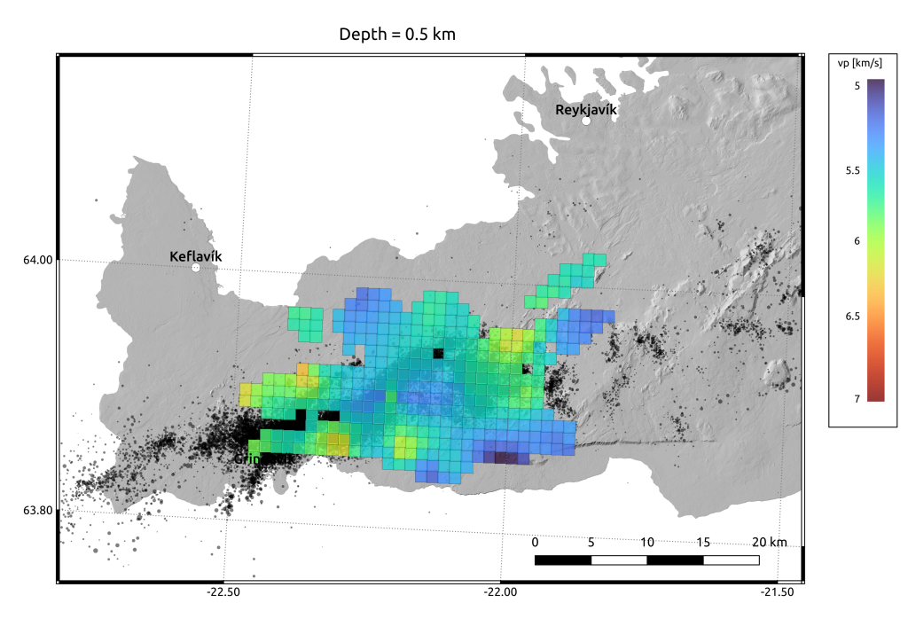
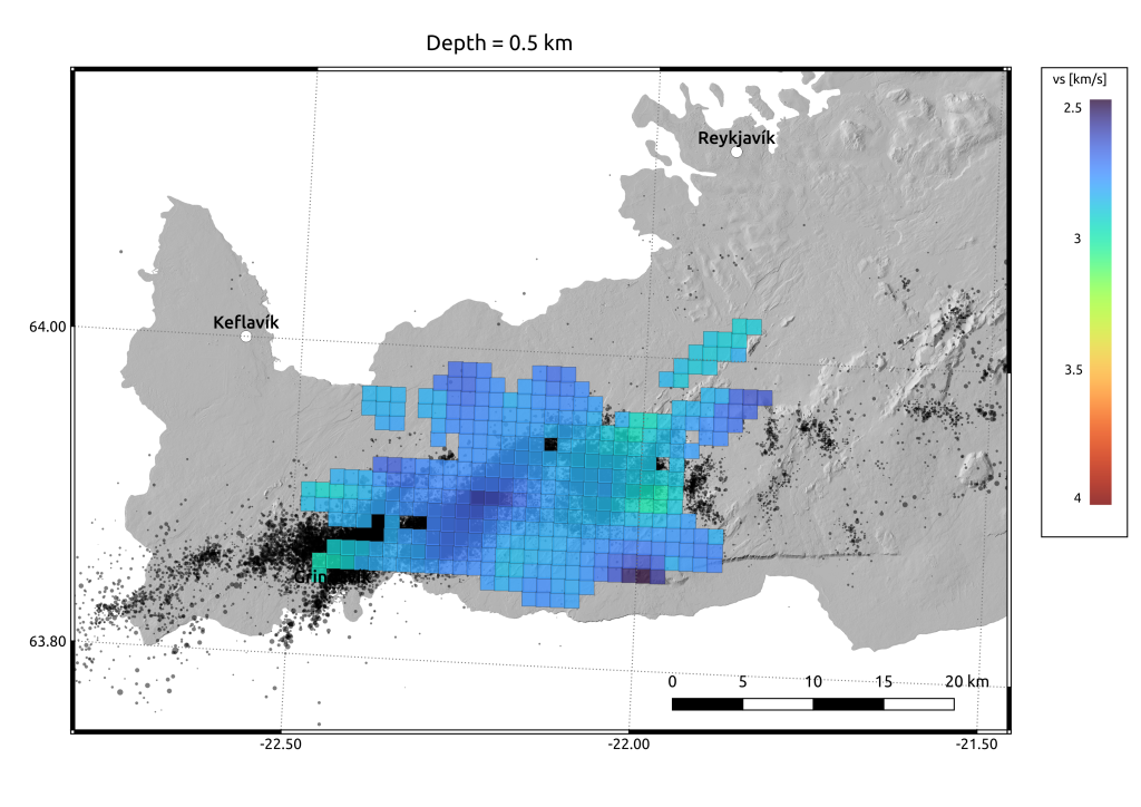
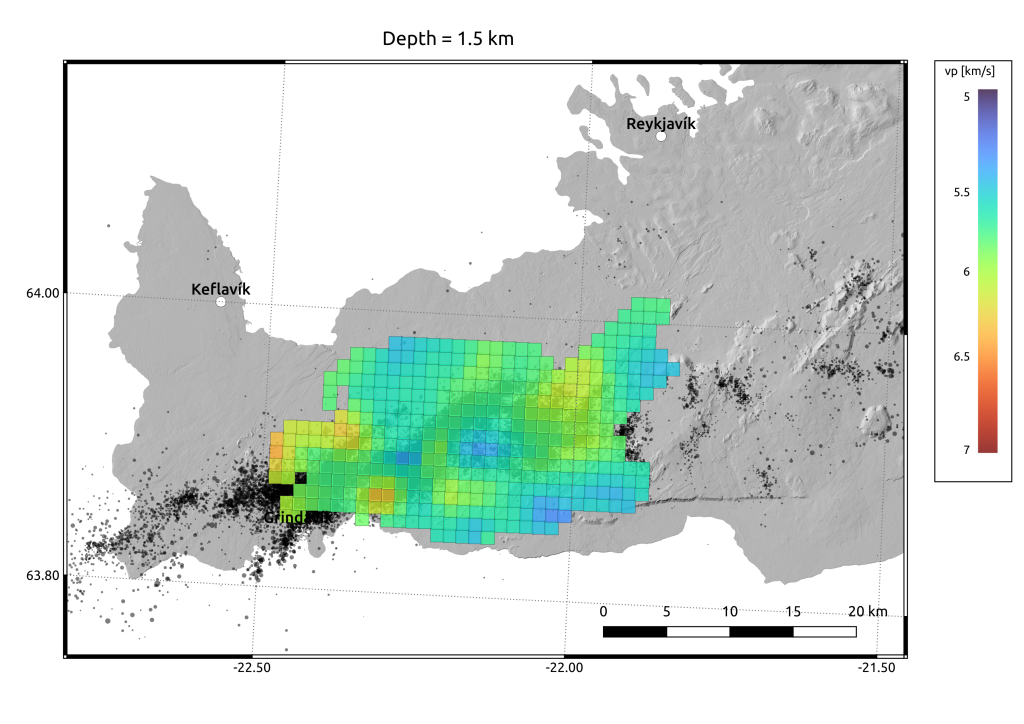
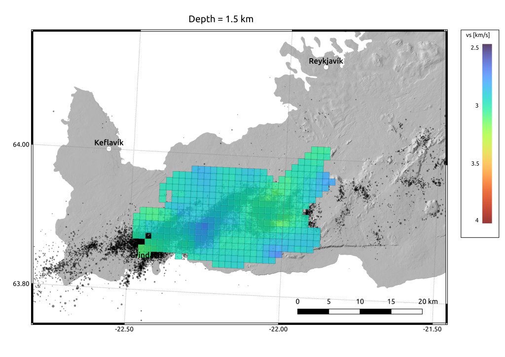
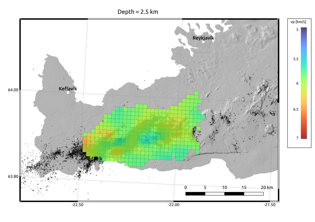
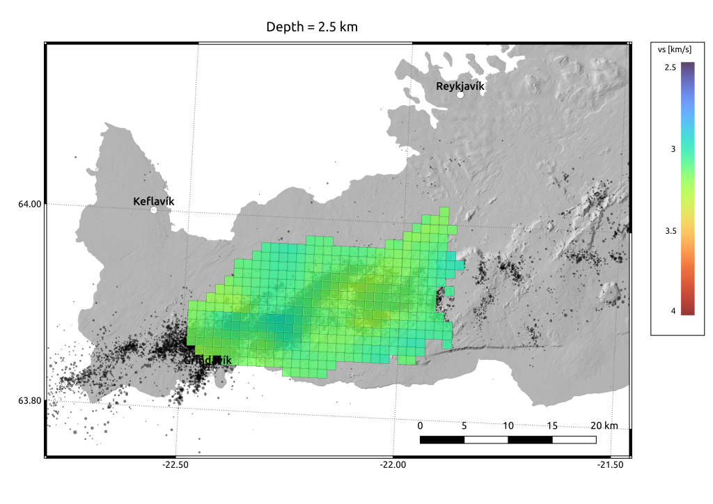
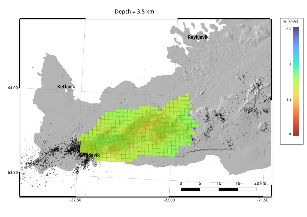
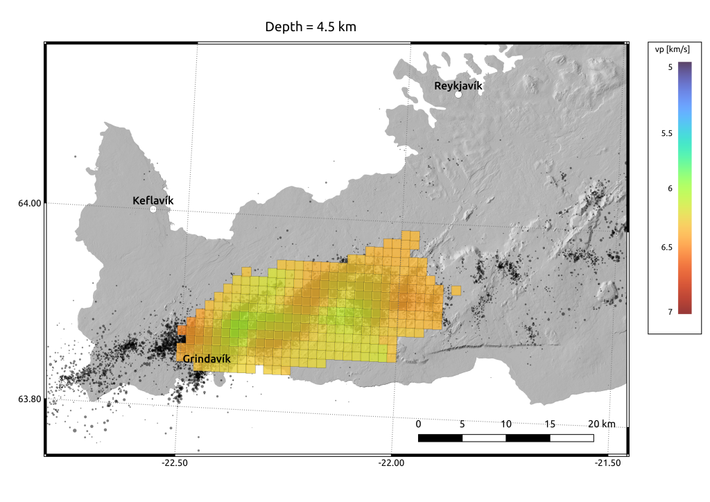
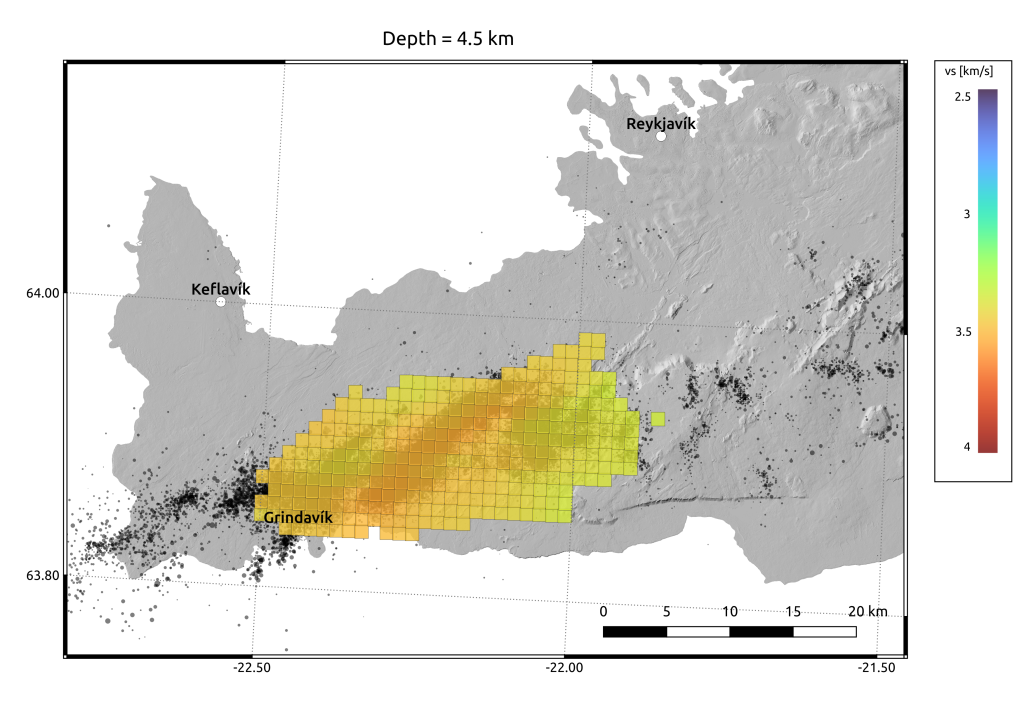
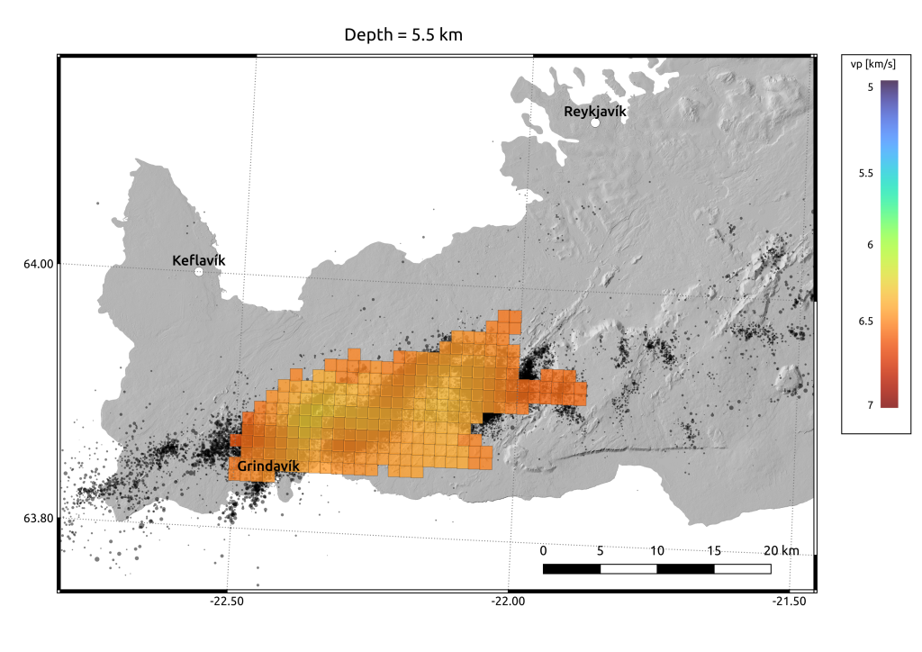
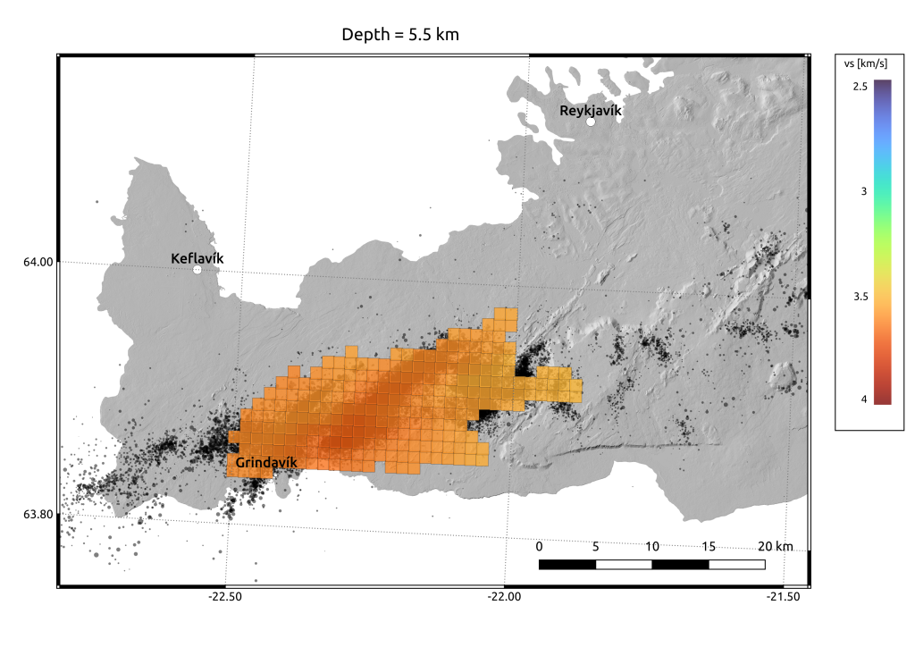
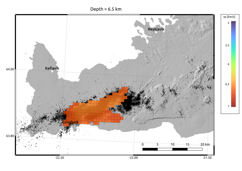
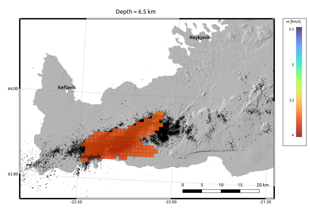
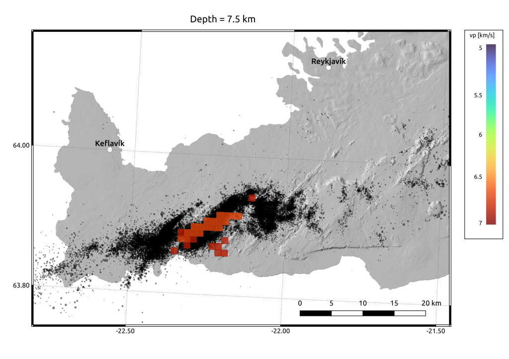
Seismic tomography was calculated using similar approach as was used previously in West Bohemia region and documented in Růžek and Horálek (2013) and in Reykjanes Peninsula documented in Růžek (2021). The geological environment is modeled by a system of rectangular boxes in contact. Each box is characterized by individual P- and S-wave velocities, which are subject of calculations. Calculation of the velocity fields is based on fitting the observed and predicted P- and S-wave arrival times of local earthquakes. We used arrival times recorded by 18 stations and corresponding to 2089 local earthquakes. Spatial resolution (dimension of the boxes) was 1x1x1 km.
Input data
List of stations in NonLinLoc format
List of events used for calculations
Bulletin of onset times
Velocity model in a numerical form
Graphical maps
Figures to download: P-waves velocity in png, P-waves velocity in pdf, S-waves veloctiy in png, S-waves velocity in pdf


ESRI Shapefiles
P-waves velocity, S-waves velocity
Coordinate systems
Apart from geographical coordinates (longitude, latitude, altitude) a local Cartesian system is sometimes used (e.g. for graphical maps). Cartesian system is using x-axis oriented eastwards, y-axis northwards, z-axis upwards. Origin of the Cartesian system is -22W 64N. For mutual transformations GMT software can be used. Example of a script is here.
References
Růžek, B., Horálek, J., 2013. Three-dimensional seismic velocity model of the west Bohemia/Vogtland seismoactive region. Geophys. J. Int. 195, 1251–1256. http://dx.doi.org/10.1093/gji/ggt295.
Růžek, B.:, 2021. Seismic anisotropy in the rift of the Reykjanes Peninsula, SW Iceland, calculated using a new tomographic method. Pure and Applied Geophysics, 178 (8), 2871-2903, https://doi.org/10.1007/s00024-021-02784-1.
