
The Environmental and applied geophysics team deals with a number of interdisciplinary topics, and one of them is the application of non-destructive geophysical methods for archaeological prospection. In a new study, GFÚ researchers Radek Klanica and Roman Beránek used a novel combination of multidimensional electrical resistivity tomography (ERT) to image stronghold fortifications. The research was done on the Early Middle Ages hillfort of Vinoř (Czechia) in cooperation with the Faculty of Arts of Charles University and the Institute of Archaeology CAS Prague.
„Using geophysical methods, we were able to locate the best preserved parts of the fortification on the Přemyslid-era hillfort, Vinoř. Afterwards archaeologists from both institutions manually dismantled and excavated the fortification line,” describes Radek Klanica. „Geophysical methods helped to target the excavation effectively. Moreover, it was a unique opportunity for us to validate our geophysical results with what was actually underground,” Klanica added.
The researchers used a method called electrical resistivity tomography (ERT), which is used for determination of electrical resistivity of subsurface Earth’s materials. Results from different measurement strategies (2D, 3D, 4D – time lapse) revealed the distinct construction components of the fortification. These included a large ditch, berm, frontal stone screen wall, and rampart. The excavations simultaneously allowed the researchers to evaluate which measurement strategy gave the best results. Ultimately, the study enhanced the connection between geophysical imaging and reality, and consequently improved the interpretation of ERT within hillfort fortifications.
Publication: Klanica et al., Characterization of stronghold fortifications by 2D/3D/4D electrical resistivity tomography: major push towards quantitative interpretation, Pure and Applied Geophysics (2024). DOI: 10.1007/s00024-024-03427-x
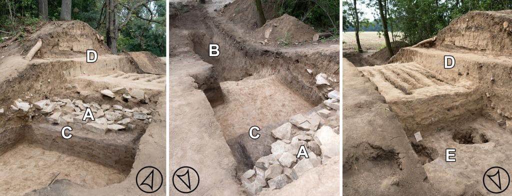
Fig. 1. Excavated parts of the fortification. A) frontal stone screen wall, B) ditch, C) berm, D) earthen rampart, E) posthole.
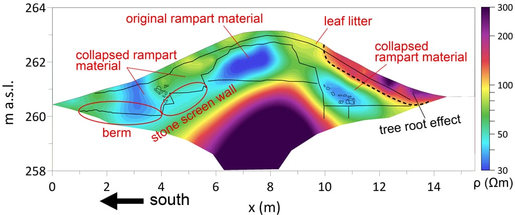
Fig. 2. 2D ERT cross section overlain by a sketch from the excavation showing the individual components of the fortification in the electrical resistivity image.
Radek Klanica