
Jezeří – online data
North Bohemia [50.5553N; 13.5052E]
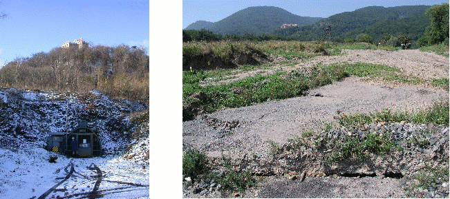
The observatory was established in 1982 when a complex investigation of the Krušné hory slopes began with the aim of controlling the stability of the slopes of an open-pit coal mine. The castle Jezeri is located just above the gallery. It is composed of two sites in a horizontal gallery, equiped with the Ostrovsky’s and ASNS tiltmeters with permanent recording of tilts. Station 1, operating since 1982, is located 410 m deep in the crystalline massif of the adjacent mountains. The target is to record the stability of this deep block of the massif suspected to rotation or sliding movements.
Station 2 was built in 2001 in order to monitor the weak zone of crystalline basement close to the contact with Tertiary sediments containing a coal seem. This station is a part of the fast geomechanic processes monitoring system of the mining company. It has clearly recorded e.g. the 2002 flood effect on block stability with anomalous tilts caused by a huge water infill in a support pillar of sedimentary formation.
This observatory has been technically upgraded for automatic data transmittion and nowadays is being prepared for real-time monitoring system establishment. The aim of the system is to provide actual continuous information on the stability of the mine slopes suspected of possible sliding. Day-to-day evaluation of the data, together with all other observed parameters, should provide indications of slope instability and warning signals for the mine authorities.
At the same time, the data are a subject to long-term earth tide effects investigation. The photos show the entrance to the Jezeří gallery and the result of landsliding at the edge of the mine (destroyed road, Jezeří castle at the back).